


Fog of World
3.692.00 Reviews
App Specs
- Version
- 3.7.2
- Updated On
- License
- $29.99
- Downloads
- 10,000+
- Developer
- Ollix
- Categories
- Travel & Local
- Platform
- Android, iOS
Screenshots
 Analysis by AppCompare
I first noticed the appeal of Fog of World in a simple habit: taking a different street home. Instead of treating a map as a tool for getting from A to B, this Travel & Local app turns the places I pass through into part of an ongoing record. Its central idea is that familiar streets and new destinations become visible on a map as I travel, giving ordinary movement a small sense of discovery.
That focus makes it different from a navigation app. I would open a route planner to find the quickest way somewhere, but I would use this to notice where I have and have not wandered. The distinction matters: its best value is not helping me arrive, but giving me a reason to explore beyond the route I already know.
Discovering the Unknown
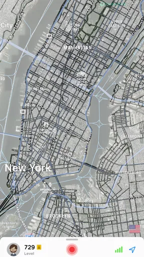
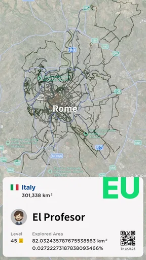
So, what’s the deal with Fog of World? Imagine playing a game where the map is covered in fog and your mission is to explore and uncover it. That's exactly what this app does, but with a twist—it's based on real-life geography. As you move around in the real world, the fog disappears from the map, revealing the places you've visited. Think of it as gamifying your travel experiences.
The map is the point, rather than a layer of directions or a list of attractions. I find that changes how I look at a neighborhood: an uncovered patch is a record of somewhere I actually went, while a blank area suggests a place I could explore another time. The reward is visual and personal. It does not need to turn every outing into a competition to make a walk feel a little more intentional.
How Does It Work?
Getting started is a breeze. Once you’ve installed the app, it uses GPS to track your movements. The interface is pretty straightforward, showing you a map with areas covered in fog. As you explore, the fog lifts, giving you a satisfying sense of accomplishment. It’s a great way to visualize your travels and see how much of the world you've conquered.
In practical use, the useful question is whether I want a live record of where I go, not just a map to consult occasionally. Location-based tracking is what lets the explored map take shape, so I would make a habit of checking that tracking is working before setting out for a long walk or trip. A quick glance afterward can help me spot gaps or see how much of a new area I covered without turning the outing into a series of phone checks.
There is a trade-off in that convenience: a location-tracking app needs access to location information while it records movement. I would decide whether that ongoing role suits my comfort level, and review the app’s available data controls before relying on it. If I only want directions for a single journey, opening a conventional map when needed is a simpler fit.
Worth Reading Before You Choose

Flipboard Shows What News Apps Must Do Beyond the Feed

Switching to Android Auto Means Rethinking Your Driving Routine

Google Calendar Makes a Crowded Week Easier to Manage

Ludo King Makes the Most of the Minutes Between Plans

Baby Panda World Brings Quick Play to Modern Phones, but Its Game Library Feels Busy

ESPN’s Live Game View Makes Following Close Games Easier
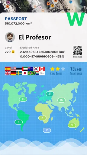
What I love is the global leaderboard. If you’re competitive like me, you’ll enjoy seeing how you stack up against other explorers. Plus, it's a fantastic motivator to get out there and explore more!
I see the leaderboard as an optional extra, not the reason to install the app. Comparing exploration can add a nudge, but it also changes the mood: a personal record of places visited is satisfying on its own, while rankings invite you to measure your progress against other people. I would use that social comparison lightly and avoid letting it dictate where I go. The more useful goal is finding an interesting route that fits my day.
The Thrill of Exploration
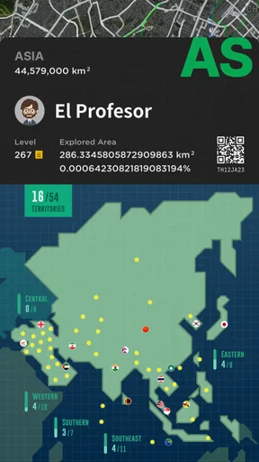
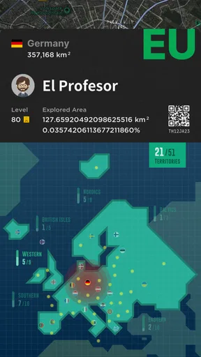
Here's where it gets interesting. The app doesn't just work in your hometown. It’s global, so whether you’re wandering the streets of Paris or hiking in the Himalayas, you’re building your own adventure. The more you travel, the more fog you clear. It's like collecting stamps in a passport, but digitally.
That makes it particularly appealing on trips where I have time between planned stops. In a new city, I might walk one street farther than necessary, take a different route back to a café, or explore a nearby block instead of calling the journey finished at the landmark. The map gives those small detours a visible result. It will not tell me which street is charming or safe, so I would still use local guidance and common sense when choosing where to go.
A realistic everyday use is a weekend walk in my own area. I could pick a destination I already need to reach, then take a safe side street on the way back and see how that changes my explored map. That keeps the app from demanding a special expedition; the outing still has a practical purpose, while the detour adds a modest discovery goal. If the weather is poor or I am short on time, I can simply follow my usual route and leave exploration for another day.
Another way to get more from the map is to treat it as a prompt for planning, not as an instruction to fill every blank. Before a day out, I can look for an unexplored area near somewhere I already intend to visit, then choose a sensible route around it. That approach keeps the experience grounded in real plans. It also avoids the trap of wandering somewhere unsuitable just to make the map look more complete.
Another cool feature is the ability to log your journeys. You can track where you’ve been and even look back at your travel history. It's a fantastic way to reminisce about trips and plan future adventures. And if you’re someone who loves keeping a diary, this digital version is a neat addition.
I would think of that history as a visual memory aid rather than a full travel journal. A route can remind me which parts of a town I explored, but it cannot capture why I stopped, what I thought of a place, or who I was with. For a trip I want to remember in detail, I would pair the map with a few notes or photos. The two approaches serve different needs: one preserves the shape of movement, the other preserves the story around it.
Why You’ll Love It
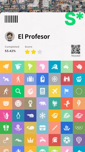
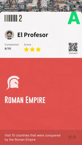
For those who love a challenge, Fog of World offers achievements and badges. It's a fun way to stay motivated and push yourself to explore new areas. Plus, it’s a great conversation starter. I mean, who wouldn’t want to brag about being a top explorer?
The challenge works best when I set a goal that suits my routine, such as walking a new route on an errand, rather than treating every blank patch as an obligation. Achievements can make progress feel tangible, but I would not expect them to replace the appeal of the map itself. If collecting rewards is the only thing that keeps someone interested, the experience may feel thin once the novelty wears off.
Also, the app is a great tool for fitness enthusiasts. Walking or biking around to clear the fog adds an exciting twist to your workout routine. It's easy to get lost in the game and forget you're actually exercising.
For walking, that can be a pleasant extra: I can choose a loop that passes through streets I have not seen, rather than repeating the same circuit. For biking, I would plan the route first and keep the phone put away while moving; watching a map while cycling is not worth the distraction. The app can make an existing activity feel more playful, but it is not a training plan and should not be treated as a substitute for one.
A Few Things to Keep in Mind
While the app is a lot of fun, it’s good to remember that it relies heavily on GPS. So, if you’re in an area with poor reception, it might not track as well. Also, it can drain your battery, so keep a portable charger handy if you’re planning a long day of exploration.
That makes it less dependable as the sole record of a trip in places where location reception is unreliable, including some remote routes or dense surroundings. I would not plan an outing around uncovering a specific stretch with the assumption that every movement will appear perfectly. For long days, battery use deserves the same practical attention as any other location-tracking activity: start with a charged phone, keep an eye on remaining power, and decide whether the map is worth running throughout the whole outing.
Privacy-wise, the app does track your location, so make sure you’re comfortable with that. However, you can manage your data settings within the app.
Price is another reason to be deliberate. The app costs $29.99, so I would not buy it just because the idea sounds amusing for a single holiday. It makes more sense for someone who expects to return to the map over time—on regular walks, repeated trips, or a long-running personal exploration project. If I mainly need turn-by-turn directions, public transport information, or recommendations for places to visit, the usual free map and travel tools are a more practical choice.
Ollix’s app is rated 3.6 on average from around 560 ratings, with 92 written reviews and over 10,000 installs. Those figures suggest a modest-sized audience rather than a universal travel essential. I would read that as a reminder to match the app to my own habits: its appeal depends on enjoying the act of gradually building a personal map, not on needing a standard navigation feature.
It is rated for Everyone, was released on December 27, 2018, and its current version is 3.7.2, with Android 8.0 as the minimum operating system. Those basics make it easier to judge whether it fits a device and household, but the bigger decision is still whether continuous location-based exploration is something I would genuinely use.
Who Gets the Most from It
I would recommend it most to people who already enjoy walking, travelling, or revisiting maps to remember where they have been. It is a particularly good match for curious locals who like discovering side streets, frequent travelers who want a visual trace of their wandering, and people who enjoy turning a normal walk into a small personal challenge. The app is less compelling for someone who wants a detailed guide, direct navigation, or a carefully organized itinerary; those jobs call for tools built around directions and destination information.
Compared with ordinary navigation apps, its strength is the sense of accumulated exploration, not route efficiency. Compared with a paper travel diary, it offers a map-shaped record rather than written impressions. Neither comparison makes it a replacement for those alternatives. I would use a navigation app to reach an unfamiliar trailhead, this app to make a record of exploring around it, and a notebook or camera when I want to preserve the details that a route cannot show.
One practical boundary is worth keeping in mind: the map records where I have moved, but it does not decide whether a detour is worthwhile. I would not cross a busy road, enter a private area, or extend a walk late at night just to uncover more. If an area is inaccessible or unsuitable, leaving it covered is the sensible outcome. That small discipline keeps the game-like goal from taking over the real-world judgment that travel still requires.
Final Thoughts
In summary, Fog of World is a fantastic app for those who love exploring and gamifying their travels. It’s perfect for adventurers, fitness buffs, and anyone who enjoys a good challenge. Whether you’re uncovering the fog in your neighborhood or halfway across the world, it’s a unique way to make the world your playground.
My recommendation comes with a clear condition: enjoy the map as a personal record, and be comfortable with the location tracking and the price before committing. If that sounds like you, the concept can give routine walks and trips a satisfying thread of progress. If you need dependable directions, destination research, or a detailed diary, I would choose a different tool for those needs instead.
So, if you're looking for an app that combines adventure, fitness, and a bit of friendly competition, give Fog of World a try. Who knows? You might just become the next top explorer on the leaderboard. Happy exploring!
Pros
- Innovative exploration-based gameplay.
- Offline mode for uninterrupted play.
- Tracks real-world travel paths.
- Offers a sense of adventure.
- Customizable map settings.
Cons
- Requires significant storage space.
- Battery drain during extended use.
- Limited social features.
- Occasional GPS inaccuracies.
- Learning curve for new users.
FAQs for Fog of World
What is the main objective of Fog of World?
Fog of World is a unique exploration app that gamifies your travel experiences. The main objective is to uncover a map by visiting new areas, allowing you to visualize where you've been and encouraging exploration. The app tracks your movements via GPS, rewarding you as you reveal more of the world map.
How does Fog of World use my location data?
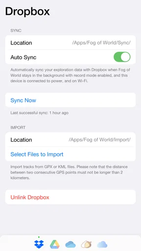
Fog of World uses your GPS data to track your travels and uncover portions of the map as you visit new places. The app stores your location data locally on your device, ensuring your privacy. You can also choose to back up your data to the cloud for security and access across multiple devices.
Is Fog of World available on both Android and iOS?
Yes, Fog of World is available for both Android and iOS platforms. Users can download it from the Google Play Store or the Apple App Store. The app offers similar features and functionality across both operating systems, ensuring a consistent experience regardless of the device you use.
Can I use Fog of World offline?
Fog of World can be used offline to track your movements and reveal the map. However, certain features, like backing up data to the cloud or accessing additional map layers, require an internet connection. Offline usage ensures you can explore without worrying about connectivity issues.
Are there any in-app purchases or subscriptions in Fog of World?
Fog of World may offer in-app purchases or subscriptions to unlock premium features, such as advanced map layers or additional customization options. These purchases enhance the user experience, but the core functionality of exploring and uncovering the map remains available without additional costs.


